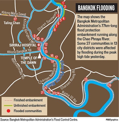
Here’s a map of flooding embankments in Bangkok, courtesy of the Bangkok Metropolitan Administration, via today’s Bangkok Post. Full story and larger map are here. So far the city has not suffered major damage.
Here’s an AP story with the latest details. More info — mostly in Thai — is available at ThaiFlood.com and the government’s official site, www.pm.go.th/flood/.
Here’s a Google Map of the flooding throughout the country, embedded below.
View Thailand Flood in a larger map
And the Twitter hashtag, of course, is #thaiflood.
Previous posts on the subject are here.
One reply on “Map of Bangkok flooding embankments”
[…] daily, details the places in central Bangkok which might flood and has comprehensive links… https://newley.com/2010/10/27/map-of-…g-embankments/ An interesting site where you can check the levels in canals… […]