UPDATE: For more recent news on the flooding here in Thailand, see this October 11, 2011 post.

According to an MCOT story yesterday, flooding here in Thailand has killed 112 people, and 26 provinces “remain under floodwaters.”
Since late July, storms and annual monsoon rains have caused the Chao Phraya and other rivers to overflow, damaging surrounding areas.
I have received some questions via Twitter about the floods.
Central Bangkok has not been affected, as far as I can tell. A visit to the Chao Phraya river, in old Bangkok, last week revealed that the waters are quite high.
However, news reports indicate that Nonthaburi, north and west of central Bangkok, are under threat as floodwaters make their way down to the city from upcountry.
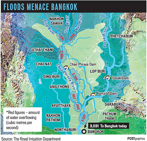
Above is a map, via yesterday’s Bangkok Post, of Thailand’s most severely affected areas. You can see that north and central Thailand, in low-lying areas near the Chao Phraya, have been hit hardest.

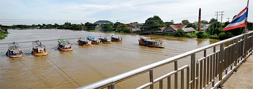
Meanwhile, a story in today’s Post says tug boats are being used to push water from Ayuttaya’s Noi River out to the ocean. I’ve never heard of the vessels being used in this way. See the image above.
Note that severe flooding also hit Thailand hit last year. See the Thailand flooding tag for previous posts.
(Images: Bangkok Post.)
One reply on “Thailand flooding: Sept. 2011”
It is time a good digital mapping be define with sea level in major flood area. The leveling should use to implement new building codes.