Very briefly:
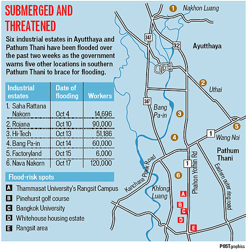
Today’s Bangkok Post has a story with a couple of new maps.
Here’s a satellite photo of Bangkok and central Thailand flooding:

And here’s a map of the industrial estates that have been affected:

Meanwhile, the WSJ says today:
Damages from Thailand’s worst flooding in decades continued to mount as parts of another industrial estate were inundated and residents worried that Bangkok remained vulnerable despite recent receding waters.
And yesterday’s NYT reported:
Fortified by dikes, runoff channels and walls of sand bags, and with workers digging and dredging around the clock, Bangkok appeared on Monday to have withstood the worst of the slow-motion tsunami that has been bearing down on it in recent days from the flooded north.
The government’s PR department has an English language update with details on tourist destinations.
The Tourism Authority of Thailand has more.