
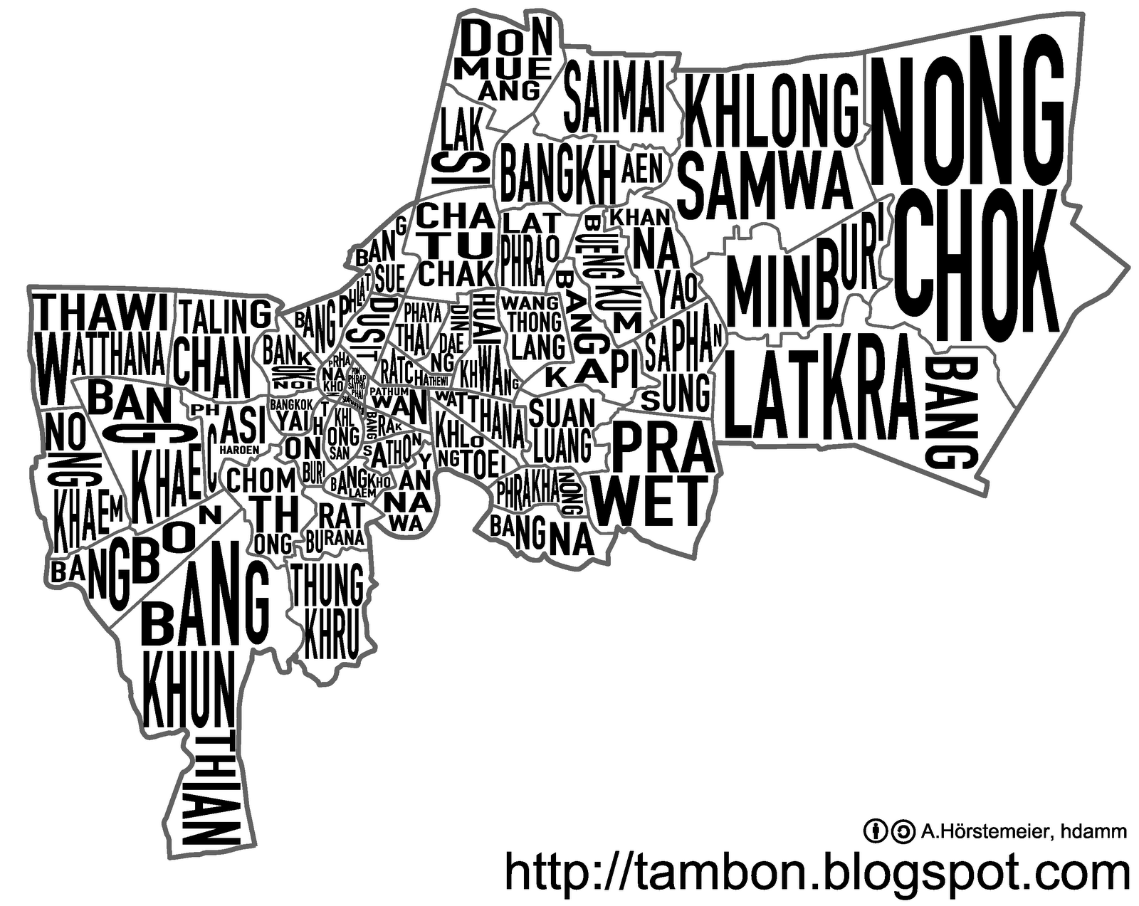
Andy, the author of the excellent blog Changwat, Amphoe, Tambon — a lovingly curated site that provides exhaustive information on Thailand’s administrative subdivisions — has created the cool map of Bangkok you see above. Here’s a bigger version.
The author was inspired, I’m happy to say, by a tweet I posted last year containing a link to Ork Posters, a company that produces typography-heavy U.S. city maps containing neighborhood names.
As Andy explains:
Luckily fellow Wikipedian hdamm already made a vector map for the districts of Bangkok, so all I had to do was to place the names on top of that. The main difficulty were the very small districts in the center of Bangkok, especially the tiny Samphanthawong with a long name. But nevertheless I think my map doesn’t look that bad, especially considering I just spend a few hours creating it and have no earlier record of being an artist or designer. There is probably still some room for fine-tuning the image, also a separate version with the names in the Thai alphabet might be worth considering, especially now I know the standard fonts for the Thai road signs. And of course one could do the same with any other of the 75 provinces, or for the whole country – but there the small provinces near Bangkok make it almost impossible to read.
Map above: Creative Commons licensed by Changwat, Amphoe, Tambon.